Outdoors

  IMG_0264 IMG_0306


Fall has not yet subsided into winter, and if you're still out hiking in Telluride, there's one last trail you should check out: Hawn Mountain. Anyone who has ever tried to walk over a talus slope or a scree field, putting their ankles in jeopardy on the shifting rocks and sometimes ending up on their backsides, will appreciate the sheer genius of the Hawn Mountain trail. Gray Head developer and longime local Steve Catsman designed this and all 16 miles of the Gray Head trails, as well as the Keystone Gorge Trail on the other side of the Telluride Valley. The trail’s switchbacks pass through ferrous rock, sharp pieces of grey and rust-colored granite. But instead of picking your way through the stones, take the stairs—an intricate staircase has been fashioned from the rocks, giving hikers a firm footing over which to pass through the scree field.

The stairway is truly amazing, maybe even as spectacular as the vantage points you reach on the hike. Doug Wolfe and his crew helped construct the rock route, and Wolfe said it took him a good two weeks to stand up without pain after it was completed.

Editor's note: For eight years, Telluride local/mountaineer Ben Clark and a few friends/professional colleagues have made Spring treks to the majestic Himalayas. Follow his adventures on Telluride Inside... and Out, including links to his regular podcasts. If you have missed any of Ben's posts, just type "Ben Clark" into Lijit Search to find them all.

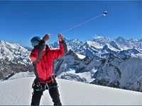
When I broke my ankle on May 1 last spring, I was at 17,600’ on 23,390' Baruntse, also known as my own personal Moby Dick for reasons you can research at www.skithehimalayas.com. Unlike Ahab, I was rescued by a vessel rather than doomed to one. Lifted into the skies, wrapped in bandages, worked over through weeks of PT and now here I am again today, returning to wrestle with ambition and not the ankle. Hopefully stronger, admittedly risk averse and yet still with an appetite for the unknown. The whale is gone though, off my range for a spell. 

by Erik Dalton


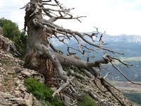
View towards Lizard Head The Hope Lake trail starts and ends in the Trout Lake area just southeast of Telluride.  I regard this hike as a classic in the fall because of the sweeping views it provides looking out towards the Lizard Head Wilderness and the Wilson Range of 14ers.  Hope Lake is also off the beaten path and a little harder to get to, so if you are looking for some solitude, it can usually be found in the high country surrounding Hope Lake.

To find Hope Lake trailhead, drive out Hwy. 145 past Ophir and turn left at the Trout Lake Road. You parallel the lake for a while before making another left on Trout Lake Road #626, which is well marked.  It's approximately a 10-minute drive from this turn to the trailhead for Hope Lake, which is easily found and marked with a large sign and accompanying map.  Be sure to bring a lunch or some snacks, as this hike is an out-and-back that leads you into the high country and offers some great spots for stopping to smell the roses – rather, wild flowers.

by Erik Dalton


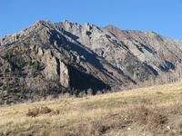
Wasatch Trail September 2010(70) Bear Creek is well known to most Telluriders. The popular hike to the falls has always been a great escape from town. Big trees, gushing creeks, and expansive views welcome hikers as they enter the canyon from the edge of town. The Wasatch Trail is essentially a continuation of the Bear Creek Trail, taking the hiker high above the falls, eventually cresting the high ridges surrounding the basin at 13,000 ft. Although the Wasatch Trail is not for the faint of heart, it is certainly a trail worth every bit of effort, especially in the fall when you can almost be assured it will be just you and the marmots up in the high country.

The Wasatch Trail is marked by a small wooden sign located in the last big flat area before you reach Bear Creek Falls. As soon as you turn right onto the Wasatch Trail, you immediately start climbing towards the cliff bands above, traversing numerous switchbacks as you work yourself high on the hillside towering over the falls.

by Erik Dalton


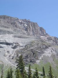
High Basin below summit-Sneffels Highline Trail The Telluride valley is surrounded by some great hikes, but none can compete with the few that take you up into the high country of our surrounding San Juan Mountains.  The Sneffels Highline Trail is one of these classics that can be completed as a loop right from town, and leads the hiker up through the pines and aspens into incredible high alpine basins and to some of the best views around.

The Sneffels Highline Trail is a 13 mile hiking loop that starts and ends in the town of Telluride, and can be accessed via the Jud Wiebe Trail at the top of Aspen Street.  The trail first loops through National Forest land on the north side of town as it climbs its way up towards Pack Basin, eventually topping out just below Mount Emma at 12,200 ft. in the Sneffels Wilderness Area.  Although the climb up from town is steep, the trail is in great condition and the effort is well rewarded along the way with incredible views down into Mill Creek Basin and back towards the ski area.  The hiker gets the sense of traveling back through time as old mining cabins and the remnants of mines and equipment can be seen scattered along the landscape. 

[click "Play" to listen to Erik and Susan discussing Fall hiking and proper gear]


IMGP1667
On the Highline

Erik Dalton, owner of Jagged Edge, grew up in the Telluride region. It's fair to say he is a mountain man with (please forgive the expression) a leg up: owning a store that caters to outdoor adventurers, he not only knows the terrain, he knows what equipment is needed to be comfortable at altitude in this terrain. The following is his short list:

Day pack that can be worn comfortably all day long

At least 3 litres of water

Raincoat, sunhat, sunscreen, chapstick

 Telluride locals, Ben Clark and Jon Miller, returned to climb and ski Baruntse, 23,390' in the Himalayas of Nepal. Their attempt in the Spring of 2009 was cut short. In this episode, Spring of 2010, we see them climbing in the 20,000' range, getting acclimated...

[click "Play" to hear Tony Forrest's conversation with Susan]

Fall Tilt Poster 8 As aspen trees blanket Telluride's mountains in gold, the big question is who wins the gold (a cash purse) at the second annual Fall Tilt in the Mountain Village.

Fall Tilt marks the last Yee! Haw! of the summer season for gonzo bikers eager to test their skills on a blistering downhill course. The event takes places Friday, September 24 and Saturday, September 25  in the Mountain Village Bike Park, four adjacent downhill trails that are to be used simultaneously for the race from 8 a.m. – 8 p.m. Terrain varies from rocky and technical riding on the World Cup course to flowing and slower riding on the "recovery" trail. (The rider gets to name his or her poison.) To keep the course safe for riders and spectators alike, the race course is taped and marked, closed to the general public and patrolled.Tech support tents and support staff will be available near the vicinity of the finish line; riders are responsible for their own repair and equipment replacement.
Carrera If any of you happened to see an outrageous vintage sports car – or two or ten or twenty - cruising over Dallas Divide last Tuesday, you were witnessing the running of the 2010 Colorado Grand, a 1,000 mile, five-day driving tour of pre-1961 sports cars that takes place each year during the third week of September and journeys over some of Colorado’s most spectacular mountain passes and scenic byways.

Since its inception in 1989, the Colorado Grand has generated more than $2.8 million via donations and auctions for Colorado charities, local organizations and foundations, as well as set up college assistant funds for students in Hotchkiss, Paonia, Ridgway and Salida.