
13 Nov TIO NZ: North Island, So Far
In Aotearoa, in the Maori’s “land of the long white cloud,” the adventure began for us on New Zealand’s North Island, according to legend, “the fish pulled from the sea by the trickster demigod Maui.”
And what a catch it is.
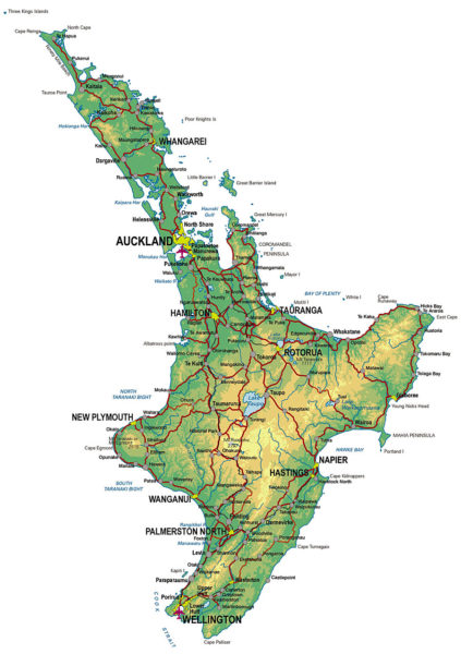
New Zealand’s North Island is rich in Maori cultural history, also in natural beauty and resources.
It is a landscape of sprawling, verdant farmlands, meandering beaches and geothermal wonders.
It is a place where marketing magic morphed maggots (or gnat larvae) into glow worms to create a thriving enterprise.
It is the first place we encountered Kiwi, a triple entendre:
Kiwi is the surrogate for locals, so called by Australian soldiers in World War I: abundant, warm and welcoming. As an example of that spirit, it should be mentioned that our hosts/guides for our first four days in the North were friends we met last year on a Mekong River cruise in SE Asia.
Kiwi is the the country’s signature fruit, also abundant and protected everywhere from the wind behind ubiquitous manicured hedges.
New Zealand’s kiwi birds are one of the world’s oddities and endangered. They have many mammalian features including two functioning ovaries, heavy bone marrow, cat-like whiskers and hair-like feathers, along with many unusual bird-like features. Kiwi birds evolved for 70 million years before man introduced the many mammals now found in the country, including on the North Island. (See below.)
On the North Island we also discovered that “speaking in tongues” is not merely a figure of speech. According to our guide (see below on Whaka), a tongue swiped left means war; extended down means peace.
We learned “Maori” is one of the country’s official languages (since 1987) and the bedrock of an oral history transcribed in elaborate carvings – and in tattoos – and only written down (again, according to our guide) after the European invasion. Now in Aotearoa vowels rule: all Maori place names end in a, e, i, o, or u.
And it was on the North Island where we got to fly to the moon, or at least a surrogate in the form of a very active volcano known as White Island. On site, the devil is in the details – in the all-pervasive smell of sulphur.
Highlights so far:
At the top of our list of musts is a helicopter ride with Aerius Helicopters to White Island, described accurately by our guides as “a geothermal experience on steroids.”

The Ring of Fire is a horseshoe-shaped band of fault lines that circles the Pacific Basin and is prone to frequent earthquakes and volcanic eruptions. It is the most seismically active zone on the planet, stretching from the southern tip of South America, up and along the west coast of North America, across the Bering Strait and down through Japan and then south to New Zealand.
The exposed White Island is just the peak of a much larger submarine mountain, which rises up to 5,249 feet above the seafloor. It is New Zealand’s only active (for over 150,000 years) marine volcano rising to a height of 1,053 feet above sea level and covering an area of about 800 acres.
White Island is on the bucket list of fisherman all over the world, also divers: hot pockets surrounding the rock support wondrous algae and coral.

Ongoing attempts to mine sulphur on White Island were finally abandoned in 1914 after boiling mud from a volcanic explosion buried 10 workers. Today, as our pilot-guides Dave and Kurtis explained, White Island is privately owned by the Buttle family. A canny ancestor allegedly purchased the place (in 1933?) from the local Maori for two barrels of rum because, said Dave, “…he thought it would be cool to own a volcano.”
Today the Buttles collect commissions and other revenues from tour operators (helicopter and boat), which add up to a tidy sum, especially, in summer when about 200 people per day visit the place.
“Not a bad retirement plan,” quipped Dave.
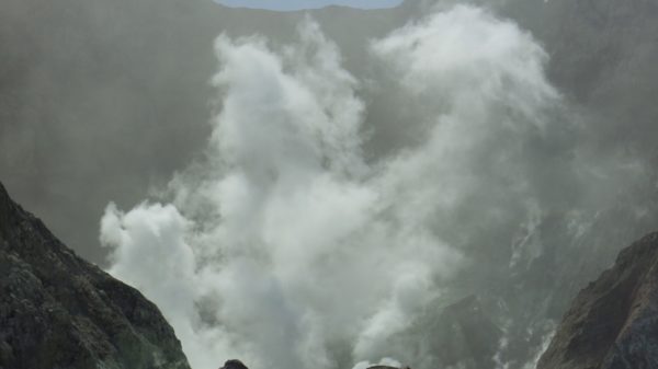
From our perch on high, at first all we could see at first was a mirage, a ghostly towering plume of steam on the horizon. The site was similar view to the one Captain Cook had back in 1769 – except he mistook the steam for smoke from Maori fires and took a powder, because as our guides explains, he feared a fight – or worse, becoming dinner.
However, although Cook gave the rock a wide birth, he also gave it its name.
As we approached, White Island looked like a solid dome of rock, but soon the dramatic crater, roughly 1.2 miles in diameter, revealed itself.
In Maori, White Island is Whaakaari, which means dramatic.
An understatement.

After a flawlessly executed scenic fly-by, we landed quietly on the crater floor and got out to explore the terrain, accessorized in hard hats and gas masks (“for insurance purposes only”).
We followed our guides across the belching, bubbling, burping surface covered with a porous volcanic rock known as scoria, which comes in colors ranging from rusty red to lemon yellow to acid green. Many areas of this lunar landscape are covered in a thin white crust of calcium sulphate, a sure sign of scalding gas trapped beneath the surface. In fact, great jets of steam mixed with hydrochloric acid and sulphur dioxide pour non-stop from the fumeroles which cover the island, sulphur chimneys so active we actually had to use our gas marks. We checked out the water. No big surprise, it is very warm. It also has the pH of around 0.3, making it more corrosive than battery acid. Dave indicated the crater lake, seasonally diminished is one of the most acidic in the world.
Our route took us to the source of the billowing steam: the edge of the large crater.
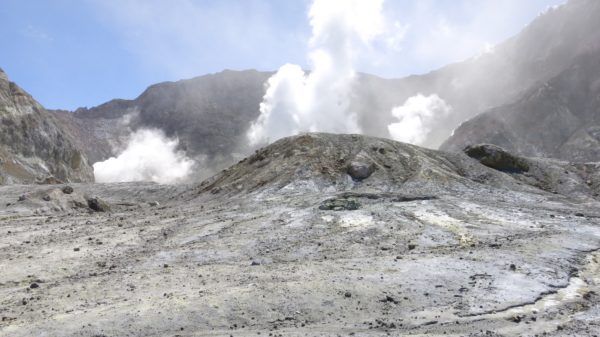
Not too surprisingly wildlife on White Island is sparse. A colony of Australasian gannets, fishing birds similar to Albatross, lives on the southern edge; otherwise, only flies, flax and a few ice plants commune with the scoria.
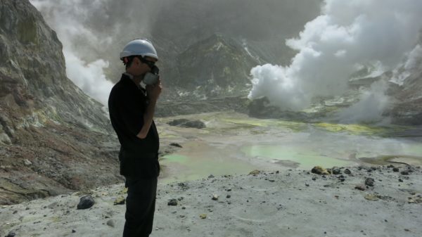
The day we visited White Island was covered in an ashy gray, the legacy of the most recent eruption in May 2016.
If you would rather not dig deep into your wallet, in addition to helicopter rides with companies like Aerius (the best), boat tours are also available, but they take all day.
Whakarewarewa, The Living Maori Village, Rotorua, aka Te Puia:

Our Maori guide
Human habitation in New Zealand dates back only about 1,000 years, giving the country the distinction of being the last land mass of size to be settled by man.
Where New Zealand’s first settlers, the Maori, came from is the subject of debate – or was. Were they wandering Aryans? Hindus? A lost tribe of Israel? Today, based on linguistics and archaeological records, the consensus is the Maori are a Polynesian people whose ancestors were Austronesian, originating in SE Asia. Speculation is the migration to New Zealand was launched in East Polynesia over several hundred years, starting in about 800 AD and ending around 1,200 AD.
Now, for over 200 years the Tuhourangi/Ngati Wahiao Maori tribe have welcomed visitors like us into their backyard (literally) at Whaka. Our guide was a gentle giant whose warmth and sense of humor matched his awesome girth.
The tour began at the Whare Tipuna Ancestral Meeting House, named after the Great Ancestor, Wahaio, whose body the stylized structure reiterates: the ends of the roof are his arms; side beams are his legs; a carved beam running down the center of the structure represents his spine; windows are his eyes; a door, his mouth; black-and-white carvings, his rib cage. The carvings themselves tell the history, the whakapapa or genealogy, of his people.
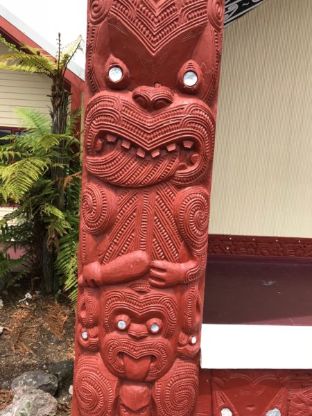
Stops included views of the houses of Whaka’s current residents (our guide’s home was just to the right of the meeting house); the communal kitchen, a place where trapped heat from underground cooks their food; a large hot springs, nicknamed “The Champagne Pool” (for a surface that bubbles when the water level drops), where veggies and seafood are prepared; and various geyser lookouts.
Our tour ended at the Cultural Performance Area, where the local performing group, Te Pakira, treated a charmed audience to traditional and modern songs and dance, plus the ferocious Haka, (a war dance), Waita a Ringa (action songs that include graceful juggling of sticks) and Poi dancing.

Note: Only two, 30-minute shows a day, 11:15 a.m. and 2 p.m.
Waitomo Glow Worm Caves:
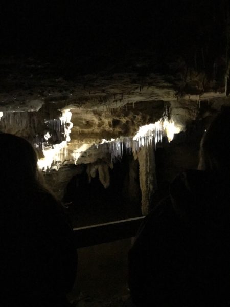
The region’s name comes from the Maori words wai (water) and tomo (hole). Under the green hills of Waitomo, about 2 1/2 hours from our perch in Tauranga, lies a labyrinth of caves, sinkholes and underground rivers that were our destination.
The leavings of the arachnocampa luminosa, aka glow worms, the leading citizens of the venue, produce a blue-green light that illuminates these legendary subterranean caves. The tiny, star-like dots attract unsuspecting flies, mosquitoes and snails who live in the water below to delicate, sticky, silky, diamond-like strings the larvae secret over 10 months. Prey are fooled into thinking they are still out under the night sky, a neat trick easy to buy into when looking up at the millions of luminescent critters shimmering against the pitch black backdrop.
The easiest and best way to see the caves is with a walking or boat tour. But if you are into big adventure, try black water rafting, which means crawling, swimming and floating through the caves on a rubber tube. You can also do a zip line.
We chose the walking tour option with Footwhistle Glowworm Cave Tours, the most intimate (read smallest group, no more than 11 peeps) way to go in the mix.
The history of these caves dates back more than 30 million years. They were first explored in 1887 by a Maori chief and an English surveyor. The two built a raft of flax to float down the underground stream and discovered the “Glowworm Grotto” when they noticed bright lights reflecting on the water. (The insect’s Maori name is titiwai, meaning “reflected over water”.)
By 1889, Maori Chief Tane Tinorau and his wife started leading tourists through the caves. New Zealand’s government took over the operation in 1906, but it was returned to Tinorau’s descendents in 1989. Now Maori families (in our case at least) lease the caves from the farmers whose land lies directly above the system.
Other:
For a quirky insight into rural New Zealand life, take in one of the local farm shows. We visited the Agrodome in the heart of 350-acres of lush farmland only 10 minutes from Rotorua city centre, where we saw the world-famous Farm Show starring an MC – the equivalent of a carnival barker – and his supporting cast of talented animals, including a about 19 different, indifferent rams, – including Cheviot, Merino Romney, Perendale, Merino, blah, blah, blah or baa baa baa – a Jersey cow, several ducks and three of the truly remarkable dogs the man trained.
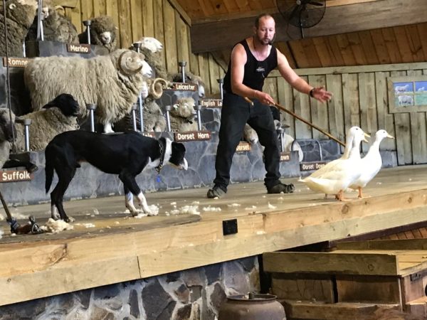
Demonstrations included sheering and herding. But mostly it was about the barker’s ability to charm the crowd. However, his Kiwi accent was so thick, to be understood the man needed subtitles.
It’s a pass unless you are traveling with kiddos.
Or you star in a popular nursery rhyme.
Set amongst the native trees and beautiful forests of Rotorua, Rainbow Springs Nature Park is a place to get up close and personal with indigenous species, including Brown and Rainbow trout, which swim to the site to spawn.

Taxidermy kiwi at the Kiwi Encounter Center, Rainbow Springs.
Another major feature of the venue is the Kiwi Encounter, a unique incubation facility, hatchery and nursery for the endangered, bird that is the nation’s icon. Kiwi became flightless because until the Maori, then the Europeans, there were no predators in New Zealand’s ecosystem. After man showed up in the Edenic landscape, European species such as weasels, stoats, possum, cats, rodents and dogs were introduced and wrought havoc on all birdlife.

Tuatara, the most ancient of all living reptiles. The species dates back about 250 million years and live to 100 years old.
Juvenile and adult Tuatara, (from the Maori language, and means “peaks on the back”), another park denizen, is the only surviving member of an order that included dinosaurs. Their lineage dates back 250 million years. Like the kiwi, the tuatara became endangered with the introduced species, especially the rat. Conservation initiatives focus on keeping existing habitat free of rodents, but captive tuatara such as the ones at Rainbow Springs. play an important role.
Worth a stop if you plan to visit Rotorua, especially with kids.
Next stop: Hawkes Bay.
Note: All images, (except the map and the small shot of White Island), are courtesy of Clint Viebrock.


Pingback:TIO NZ: Hawke's Bay, | Telluride Inside... and Out
Posted at 02:13h, 16 November[…] TIO New Zealand: North Island, So Far – November 13, 2017 […]